Was genau ist ein suntag.ch-Bericht?
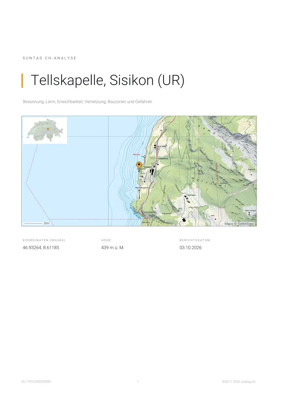
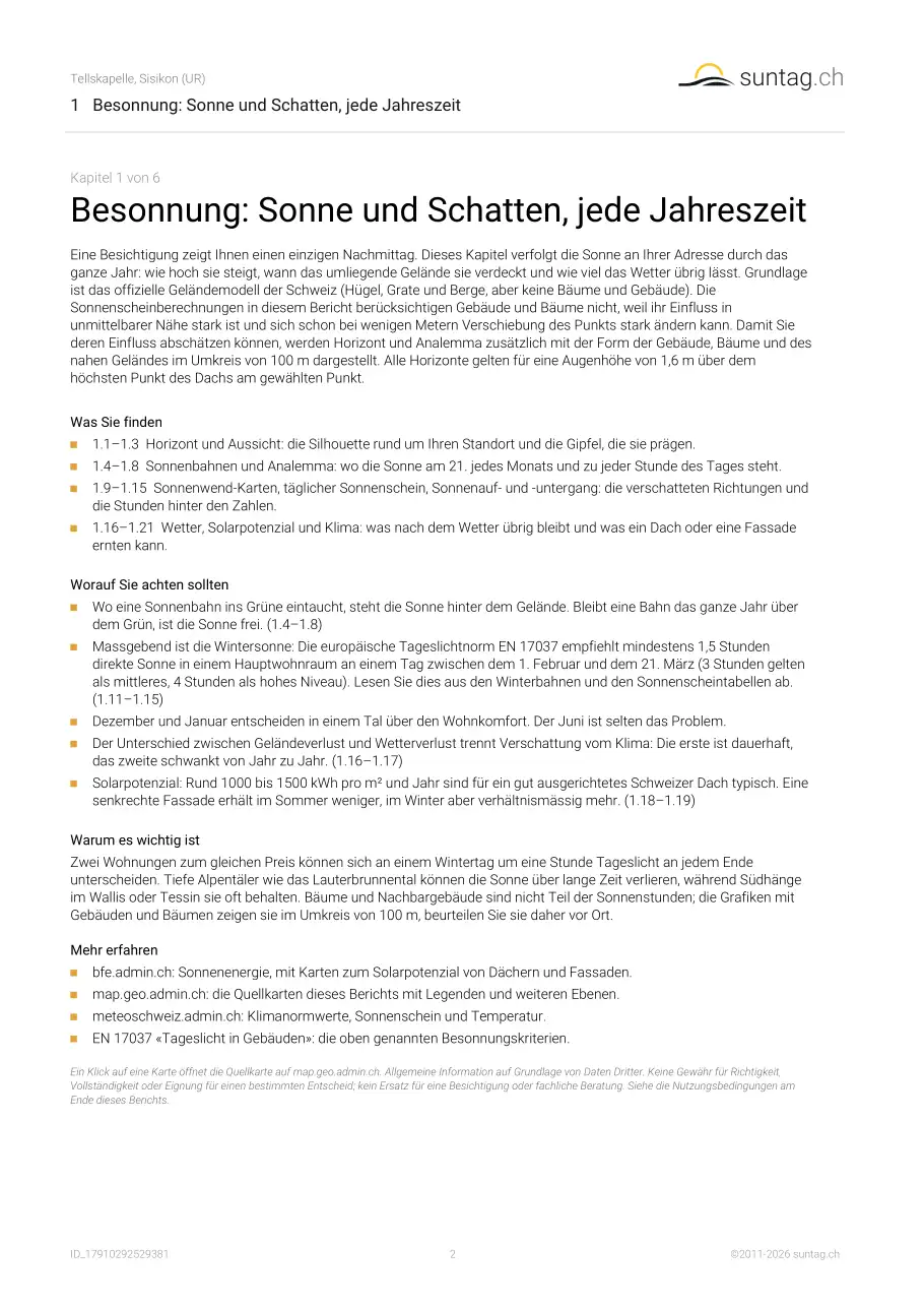
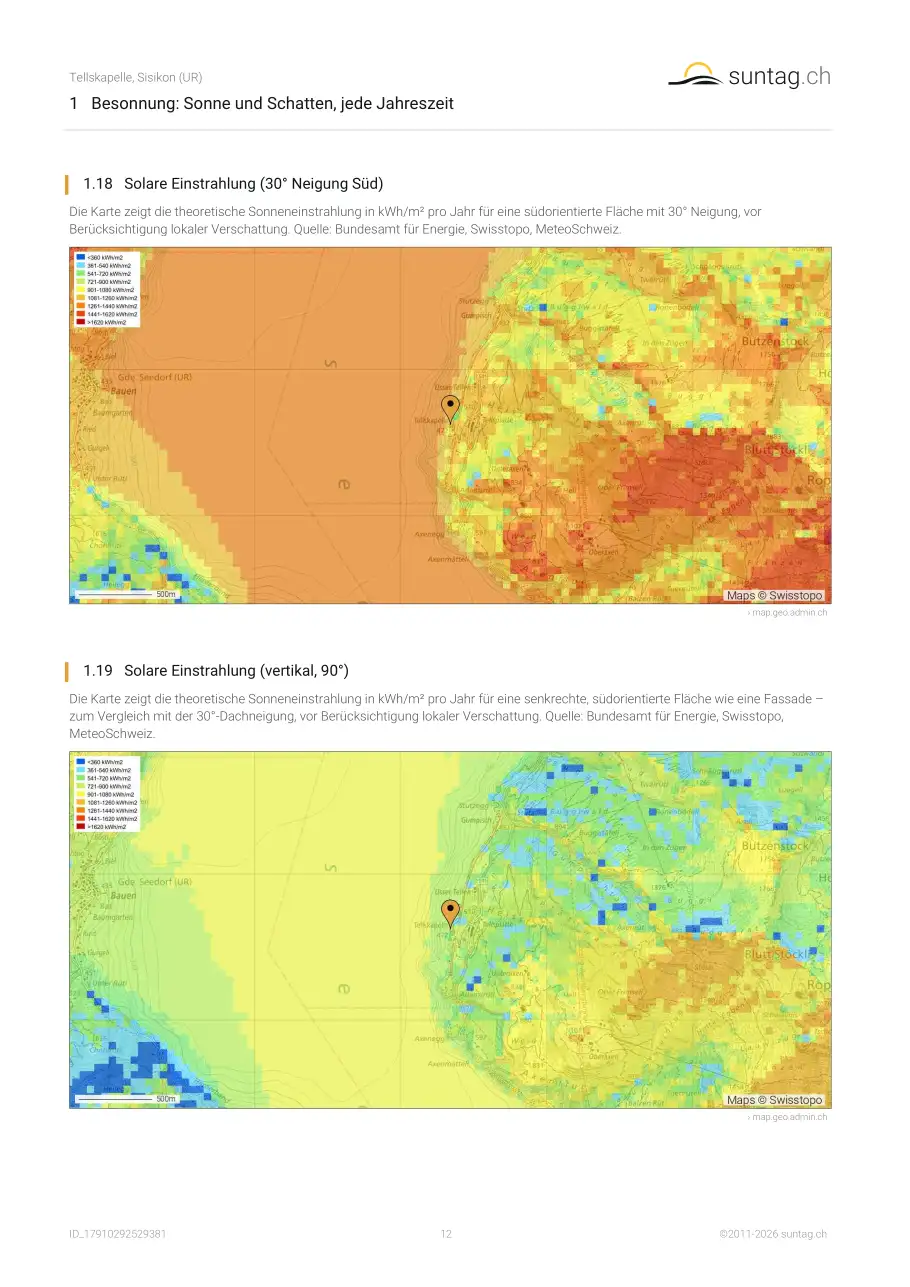
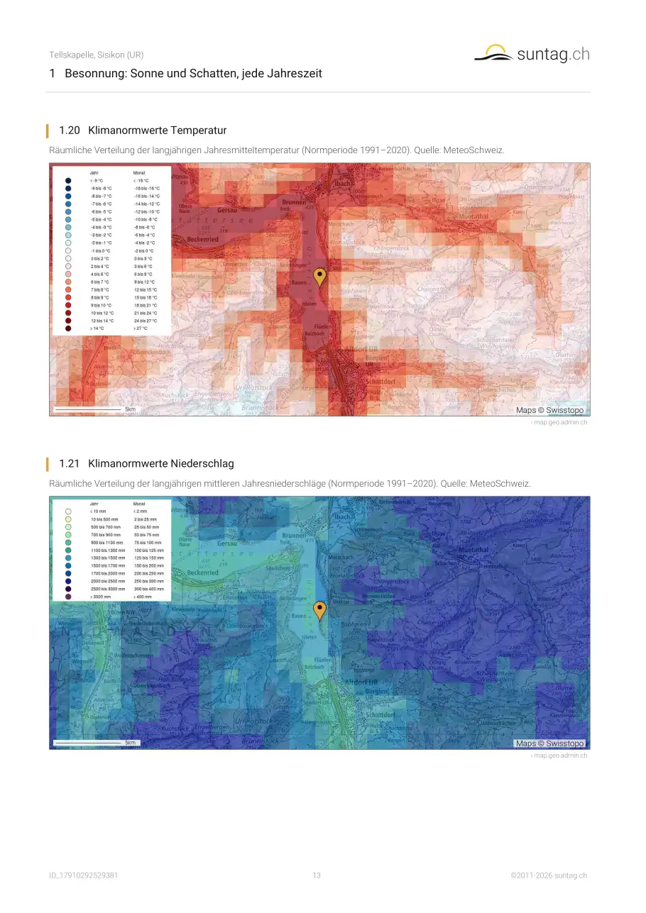
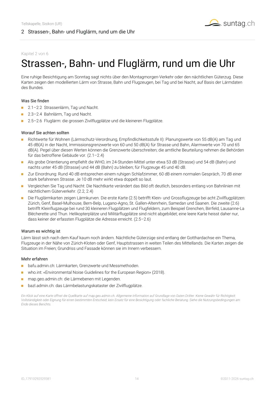
Eine automatisch erstellte 32-seitige PDF-Analyse eines einzelnen Standorts in der Schweiz oder in Liechtenstein, mit 12 Grafiken, 31 Karten und 3 Tabellen, fertig in unter zehn Sekunden. Kern ist eine Besonnungs- und Verschattungsanalyse – wie viel Sonne der Punkt übers Jahr erhält und wie das umliegende Gelände sie je nach Jahreszeit abschattet, ergänzt um den Sonnenstand Stunde für Stunde. Dazu kommen die Ebenen, die den Alltag an dieser Adresse prägen: Strassen-, Bahn- und Fluglärm, Erreichbarkeit mit Auto und öffentlichem Verkehr samt Erschliessungsqualität, Mobilfunkanlagen, Radio- und Fernsehsender, Hochspannungsanlagen, Notfallschutzzonen um Kernkraftwerke, Mobilfunk- und Breitbandabdeckung, Solarpotenzial, amtliche Bauzonen, Bevölkerungsdichte, Erdbeben-, Radon-, Lawinen- und Hangmurenrisiko sowie langjährige Klimamittel. Sonnenscheingrafiken und -tabellen, Horizont und Sonnenstand nach Uhrzeit zeigen zusätzlich, als weniger genaue Angabe, den Einfluss der Gebäude, Bäume und des nahen Geländes im Umkreis von 100 m.
Was ist Besonnung, und warum ist sie wichtig?
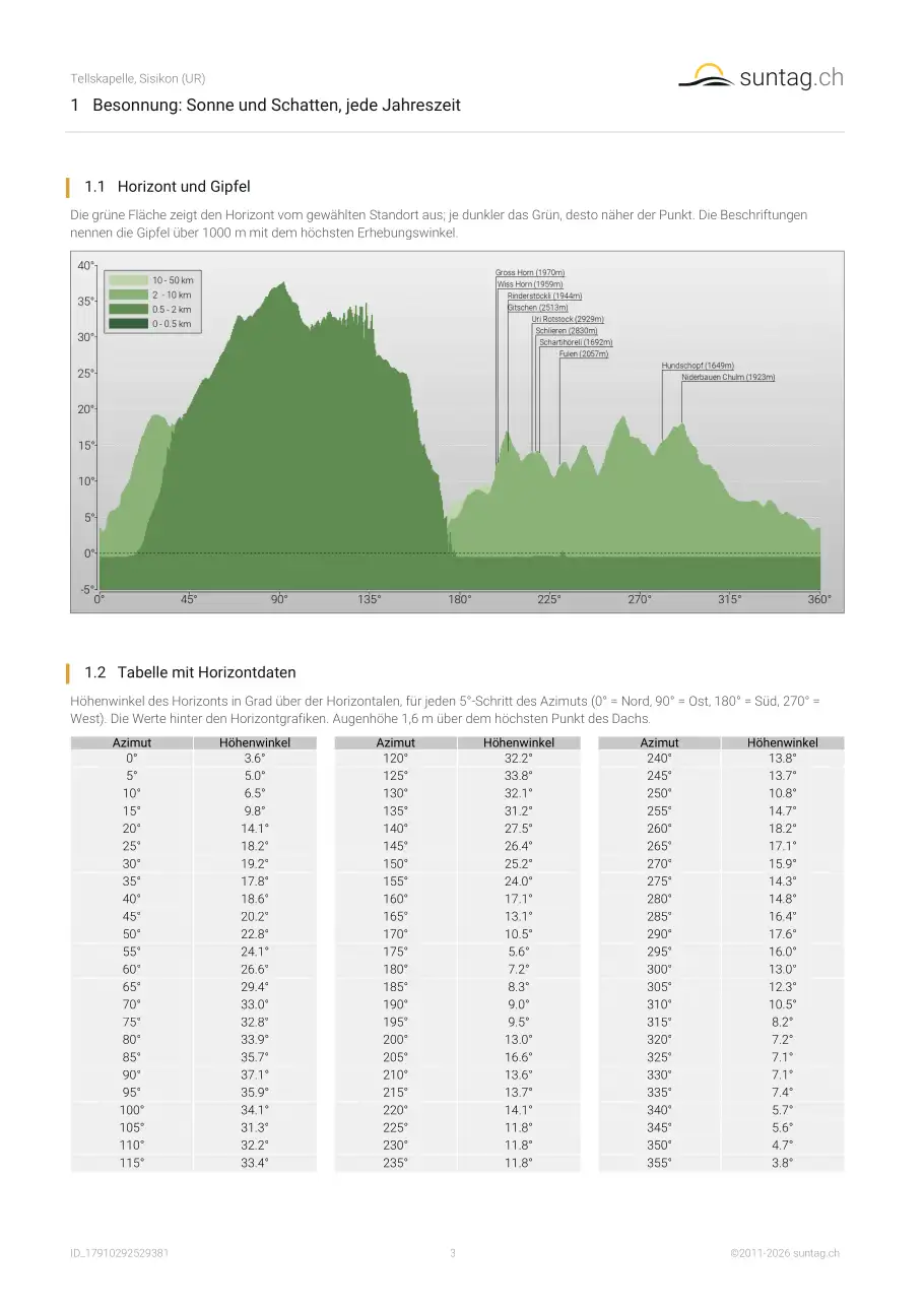
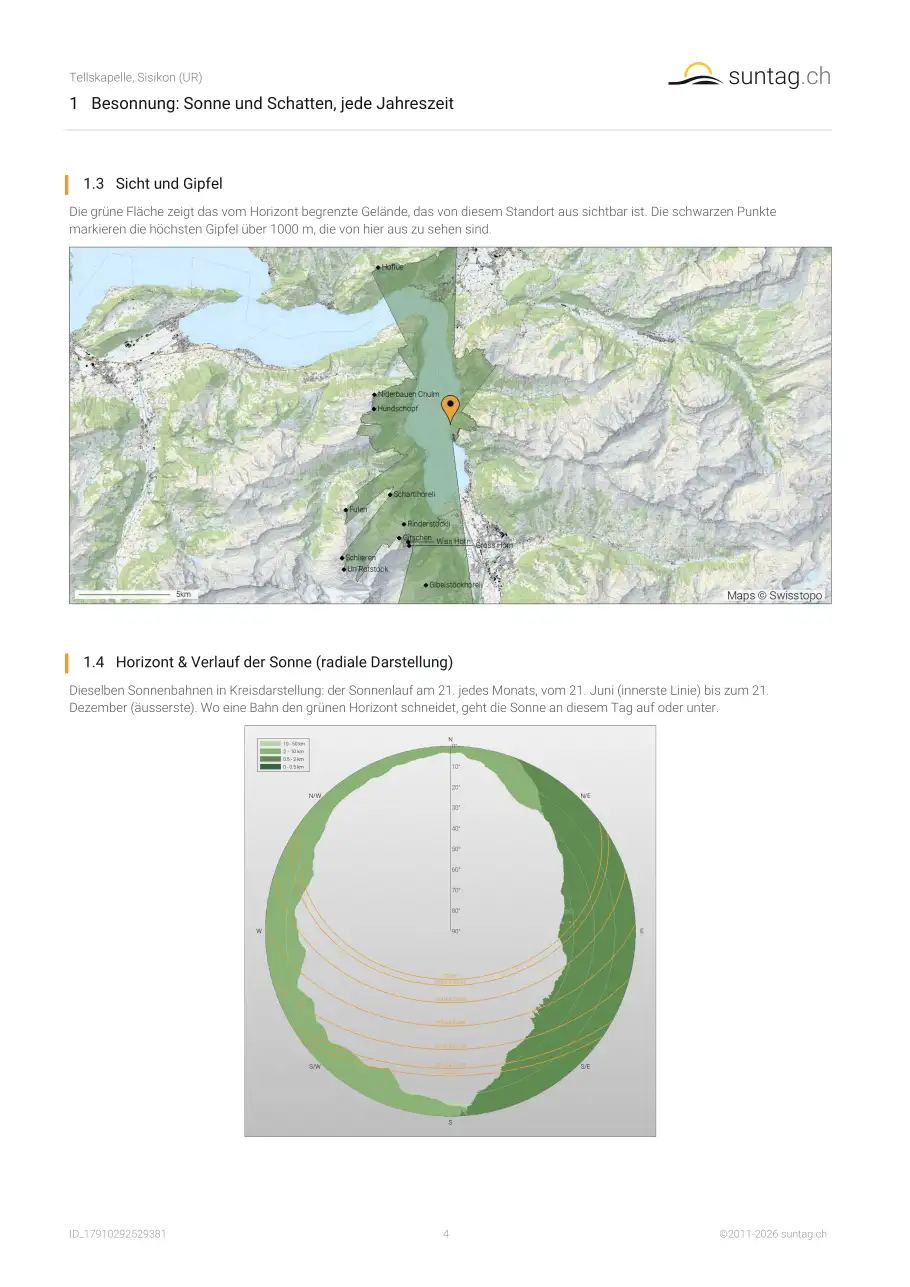
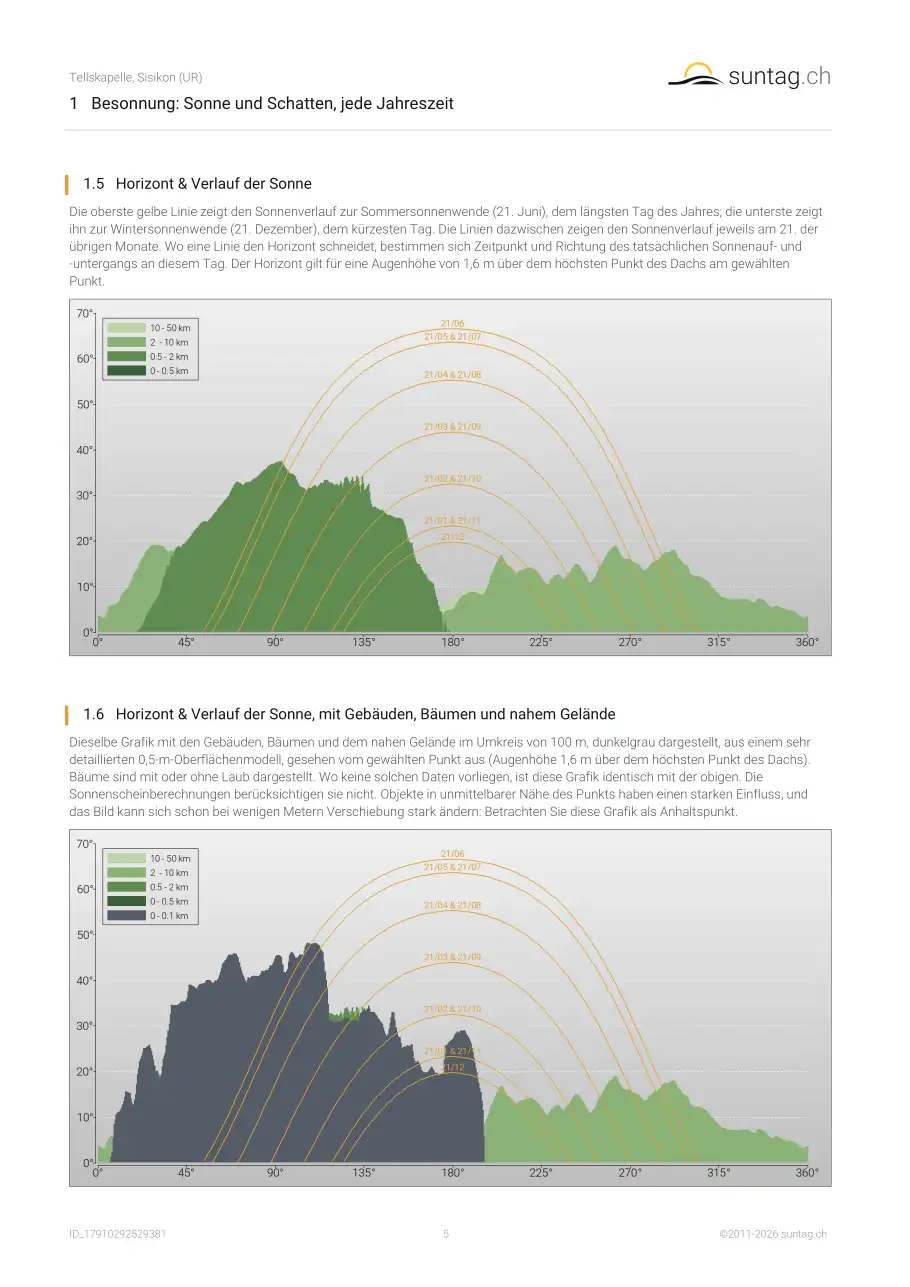
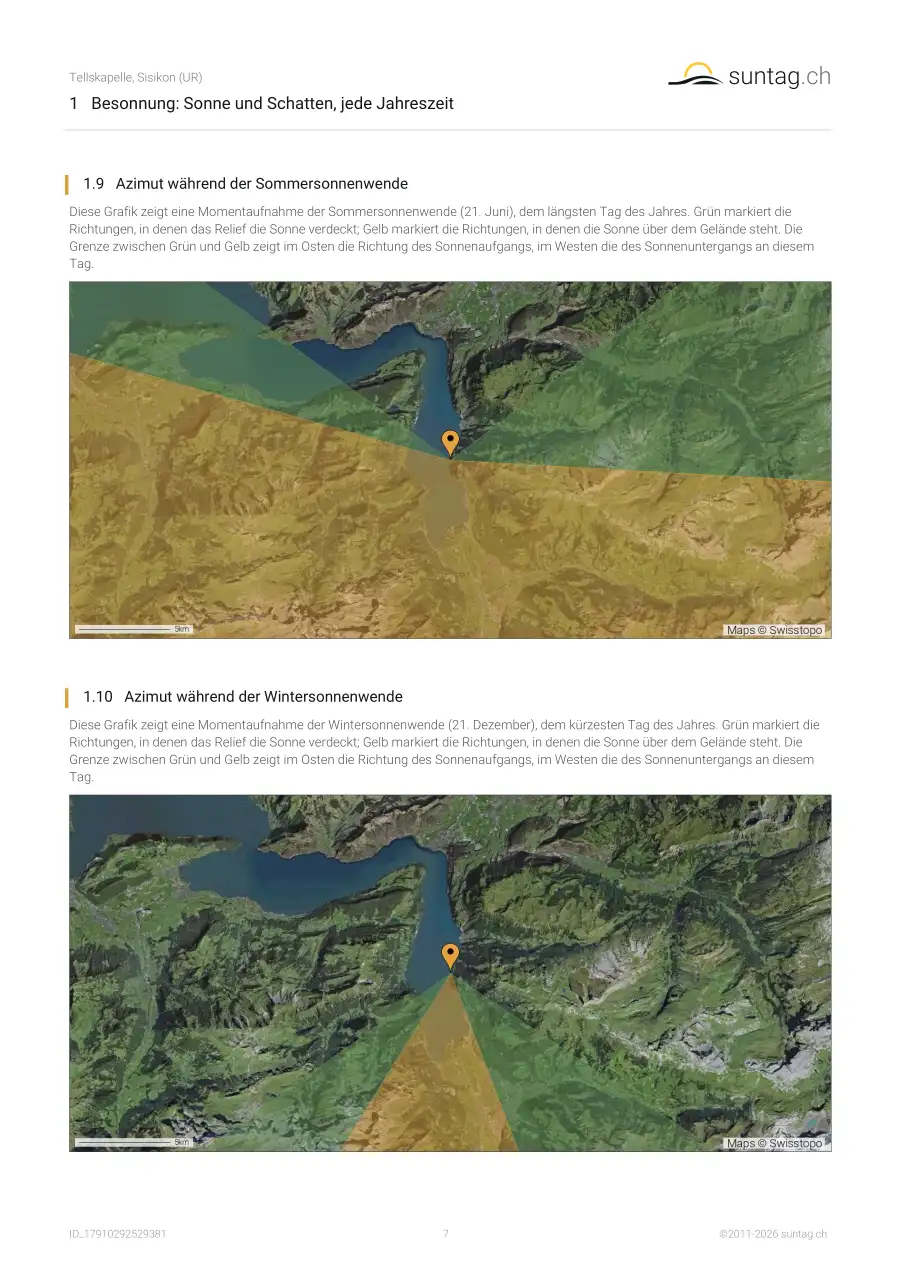
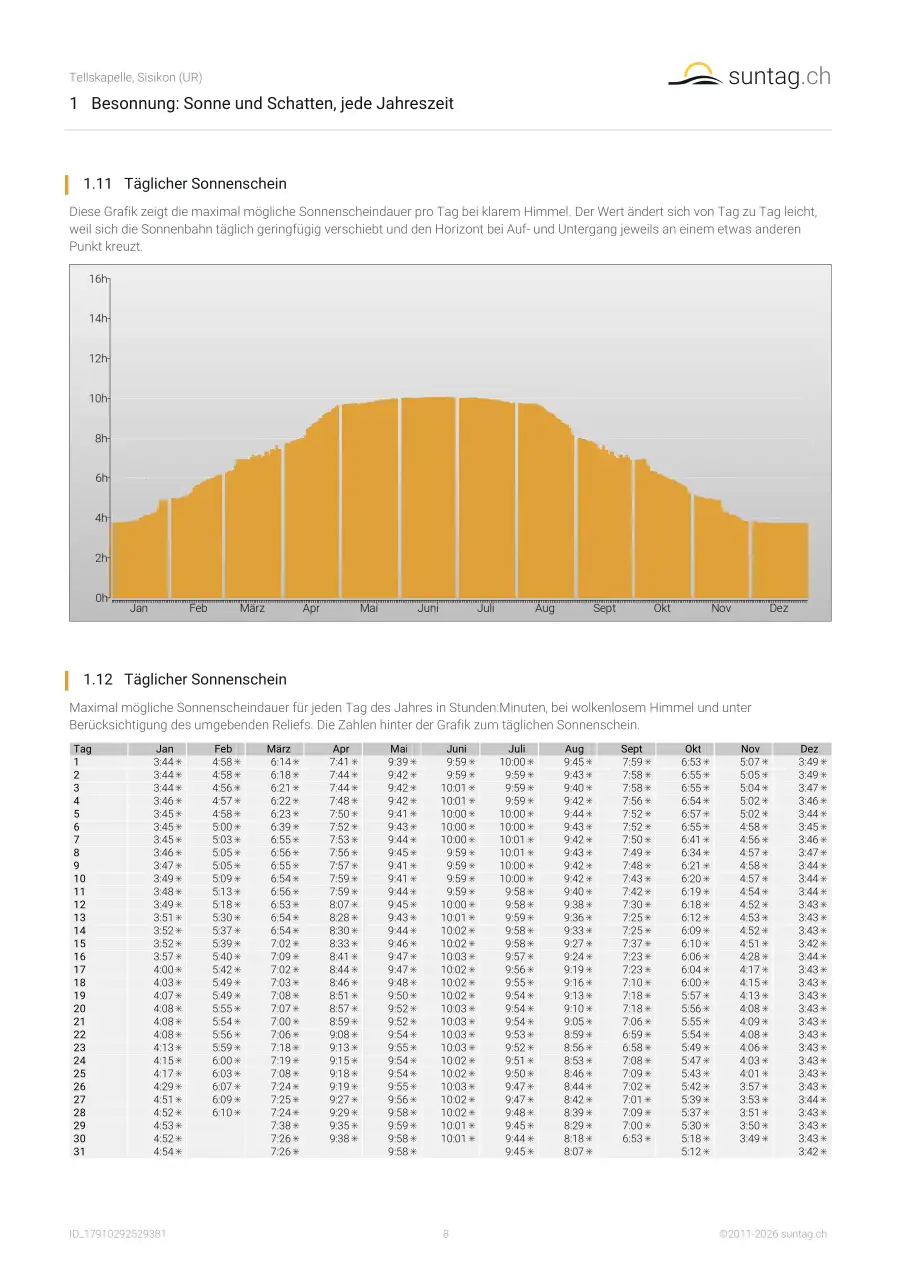
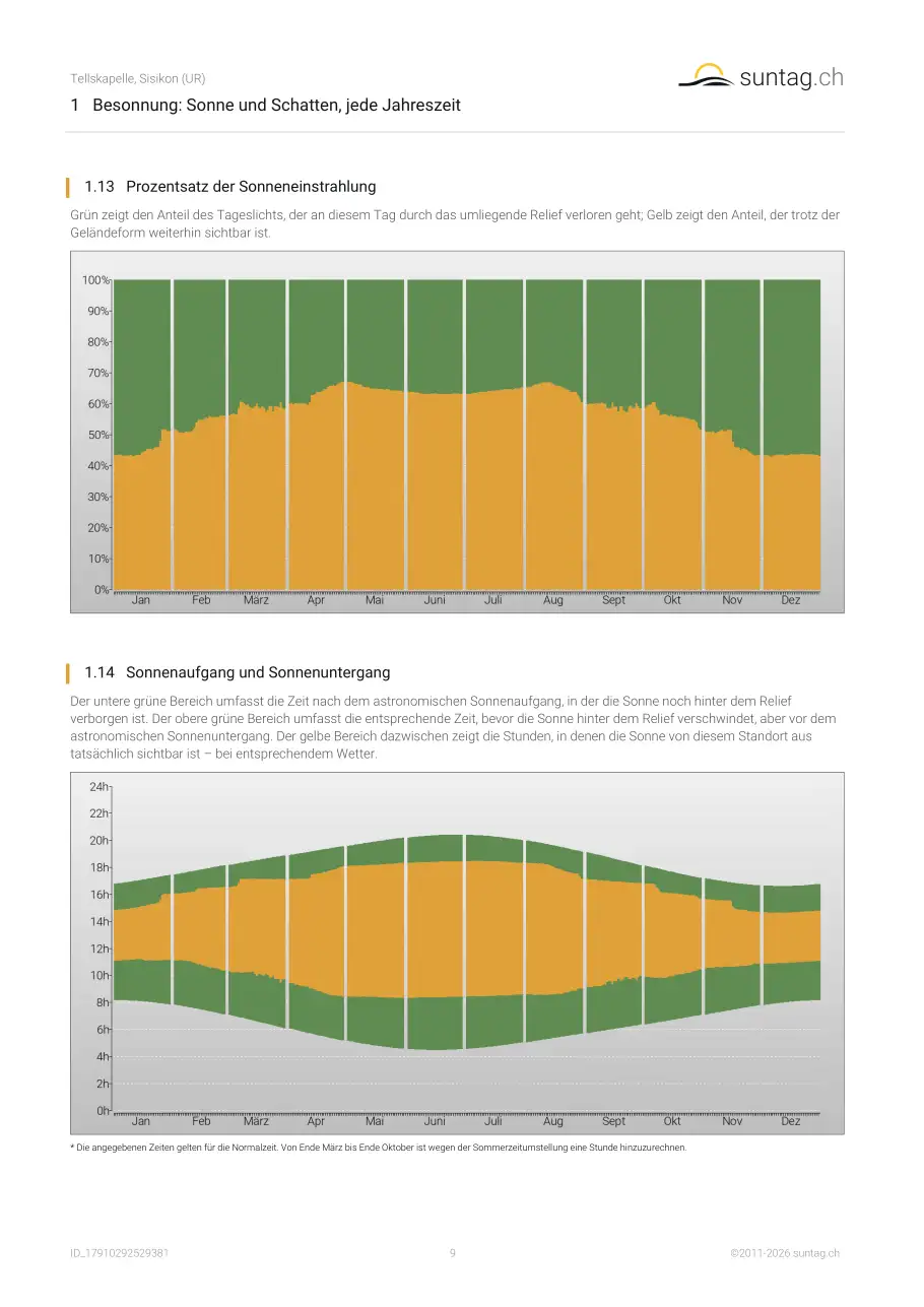
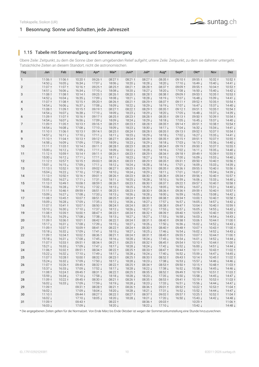
Besonnung ist, wie viel direkte Sonne ein Standort übers Jahr tatsächlich erhält – abhängig von Jahreszeit, Sonnenstand und den Hügeln, Graten oder Bergen, die den Horizont bilden. Sie beeinflusst das Tageslicht, den Heiz- und Kühlbedarf und die Nutzbarkeit eines südseitigen Balkons im Alltag. suntag.ch berechnet sie für jede Adresse in der Schweiz Tag für Tag übers ganze Jahr, auf Basis des echten Geländemodells von swisstopo – nicht nur des astronomischen Sonnenstands, wie ihn einfachere Rechner verwenden. Mehr dazu in unserem
Besonnung-Ratgeber für die Schweiz.
Was sollte ich an der Lage einer Immobilie prüfen, bevor ich kaufe oder miete?
Wie viele Sonnenstunden braucht ein Haus?
Mehrere Stunden direkte Sonne auch im Winter tragen zum Wohnkomfort bei; reine Nordlagen oder stark verschattete Tallagen schneiden deutlich schlechter ab. Der suntag.ch-Bericht zeigt die effektive Besonnung Ihres Standorts Monat für Monat, inklusive der kritischen Wintermonate November bis Februar, in denen umliegende Berge und Hügel die Sonne am längsten blockieren.
Wie wird sie berechnet?
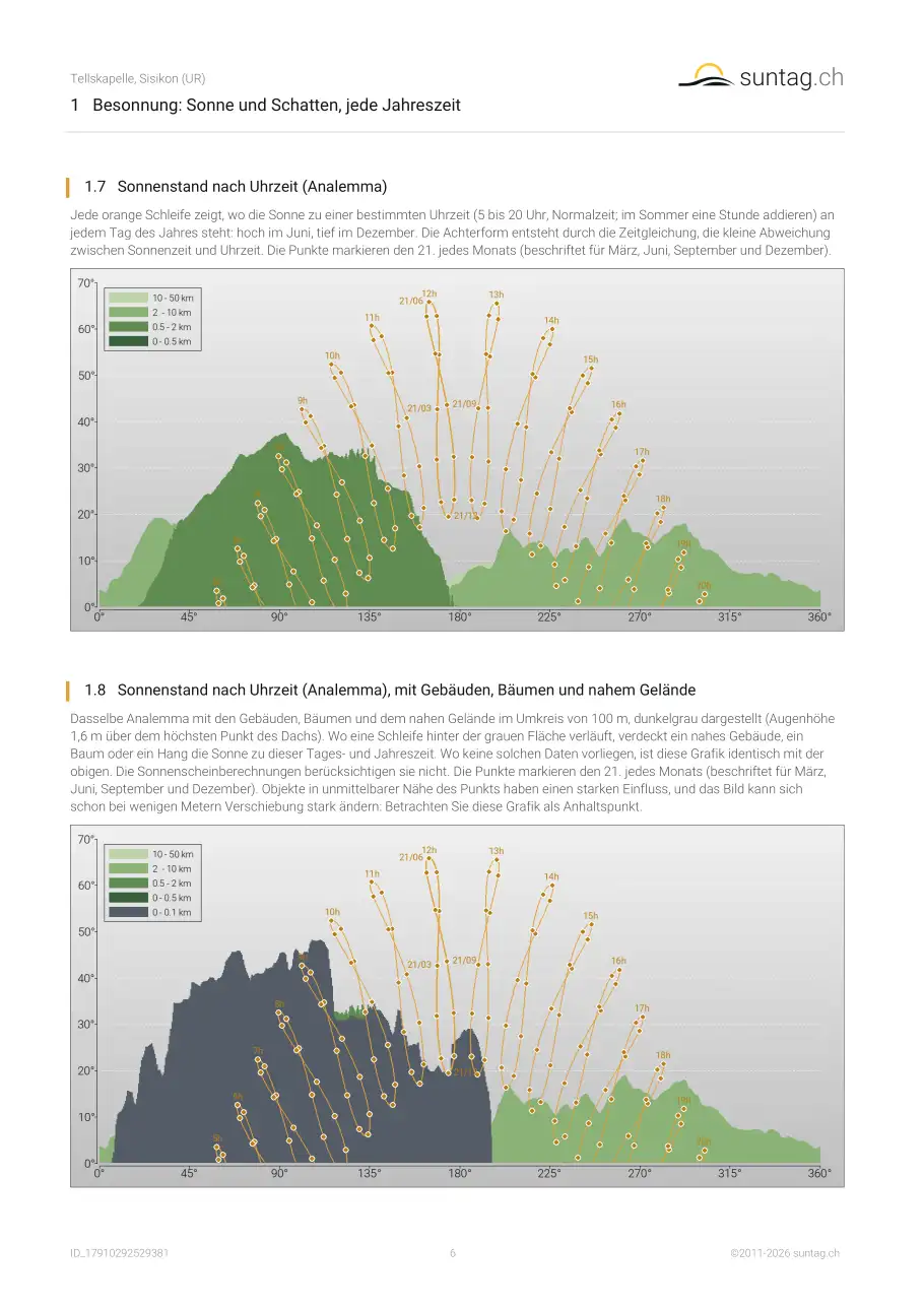
Aus einem digitalen Geländemodell der Schweiz – einem 25-Meter-Höhenraster von swisstopo – kombiniert mit dem exakten Lauf der Sonne übers ganze Jahr. Für Ihren Punkt verfolgt suntag.ch den Horizont in alle Richtungen, ermittelt den Moment, in dem die Sonne jeden umliegenden Hügel und Berg freigibt, und summiert die daraus resultierende besonnte Zeit. Gebäude, Bäume und nahes Gelände im Umkreis von 100 m um Ihren Standort, aus dem 0,5-m-Oberflächenmodell von swisstopo, werden in den Sonnenscheingrafiken, den Sonnenscheintabellen sowie in Horizont und Analemma als gesonderte Angabe ergänzt, dunkelgrau oder als zweite Spalte. Sie ist weniger genau: Gebäude werden als einfache Blöcke modelliert, Bäume verändern sich mit den Jahreszeiten, und was nahe liegt, hängt von der genauen Position des Beobachters ab. Alle Horizonte, mit oder ohne Gebäude, Bäume und nahes Gelände, werden für eine Augenhöhe von 1,6 m über dem Boden am gewählten Punkt berechnet, auch wenn der Punkt auf einem Gebäude liegt. Das Gebäude, auf dem der Punkt steht, bleibt in der Version mit Gebäuden unberücksichtigt, ein Nachbargebäude erscheint dort als Hindernis.
Was berücksichtigt der Bericht nicht?
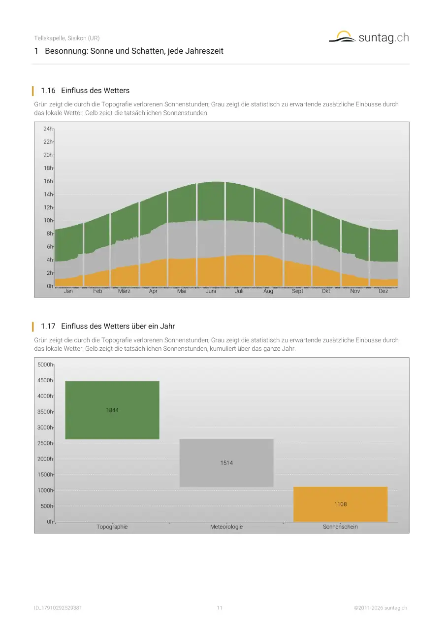
Bäume und Vegetation, Gebäude und andere Bauten sowie jede Bauveränderung – bestehend, geplant oder nach der Erstellung hinzugekommen. Das Geländemodell enthält bewusst keine Bäume und Gebäude; die Analyse gibt also die Form des Geländes selbst wieder, nicht das, was darauf gebaut ist oder wächst. Wetter und Luftqualität werden ebenfalls nicht berücksichtigt. Alle Werte sind Schätzungen und können von den Verhältnissen vor Ort abweichen. Der Einfluss von Gebäuden und Bäumen ist in unmittelbarer Nähe stark und kann sich schon bei wenigen Metern Verschiebung des Punkts stark ändern. Grafiken und Tabellen zeigen ihn deshalb gesondert, im Umkreis von 100 m, als weniger genaue Angabe zusätzlich zu den geländebasierten Werten.
Wie genau ist er?
Die Geländedaten und die Berechnung des Sonnenlaufs sind exakt. Wie gut der Bericht mit dem übereinstimmt, was Sie tatsächlich sehen werden, hängt davon ab, was den Horizont an Ihrem Standort bildet: Sind es Hügel und Berge, erfasst der Bericht sie gut; ist es ein Nachbargebäude oder eine Baumreihe, kann er das nicht – diese sind nicht im Geländemodell enthalten. Offene, ländliche Standorte stimmen daher besser mit der Wirklichkeit überein als dicht bebaute. Um ein nahes Gebäude oder einen Baum einzuordnen, helfen die Horizont- und Analemma-Grafiken, die sie enthalten; sie erlauben eine Abschätzung der Wirkung, die aber nicht in die Sonnenscheinzahlen einfliesst. Objekte in unmittelbarer Nähe des Punkts haben einen starken Einfluss, und das Ergebnis kann sich schon bei wenigen Metern Verschiebung des Punkts stark ändern.
Kann ich damit entscheiden, ob ich irgendwo kaufe, miete oder baue?
Er ist eine nützliche Grundlage, kein Urteil. Der Bericht ist allgemeine Information – kein Gutachten, keine Vermessung und keine architektonische, rechtliche oder finanzielle Beratung – und sollte nicht die alleinige Entscheidungsgrundlage sein. Nutzen Sie ihn, um Standorte direkt zu vergleichen, ein offensichtliches Problem früh zu erkennen, oder mit den richtigen Fragen bereits im Kopf zur Besichtigung zu gehen.
Kann ich damit Solaranlagen planen?
Ja. suntag.ch zeigt nicht nur, wie sonnig ein Ort ist, sondern erfasst auch den genauen Horizont darum herum – genau die Verschattungsangabe, die ein Ertragsrechner braucht, um abzuschätzen, was eine Solaranlage an diesem Standort tatsächlich produzieren würde.
Zeigt der Bericht, wo Mobilfunkantennen stehen?
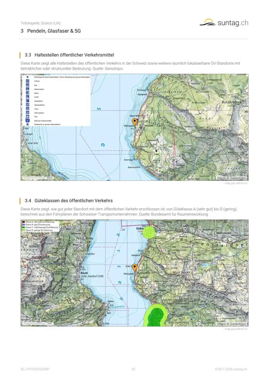
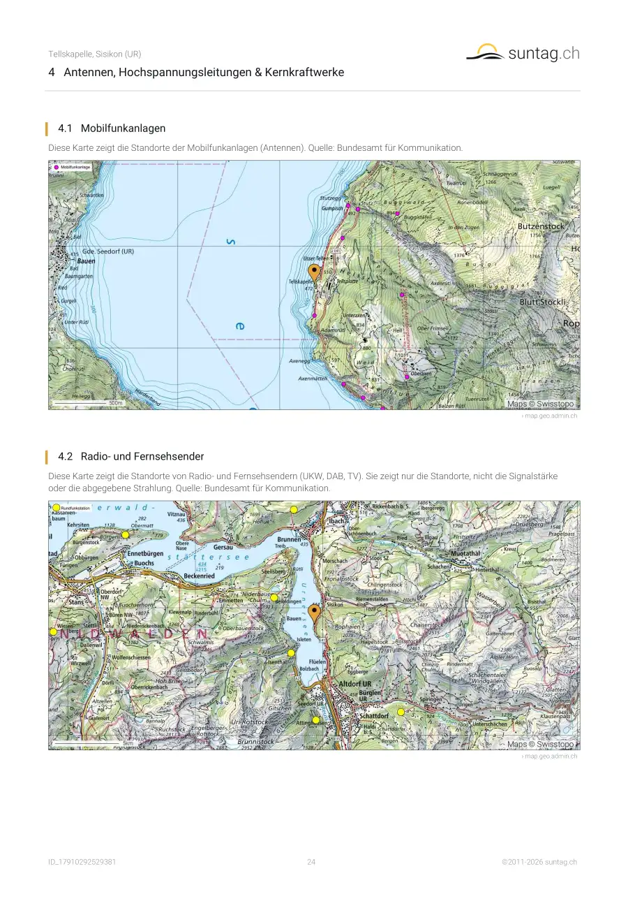
Ja. Neben der 4G- und 5G-Abdeckung zeigt der Bericht die Standorte der Mobilfunkanlagen rund um Ihre Adresse – zusammen mit den Reisezeiten mit Auto und öffentlichem Verkehr und den ÖV-Haltestellen. So sehen Sie nicht nur, ob der Empfang gut ist, sondern auch, wo die nächsten Antennen tatsächlich stehen – etwas, das eine Besichtigung selten verrät. Die Daten stammen vom Bundesamt für Kommunikation (BAKOM). Unser
Ratgeber zu Antennen, Hochspannung und Kernkraftwerken erklärt, was die Werte bedeuten.
Wie finde ich heraus, wie laut es an einer Adresse ist?
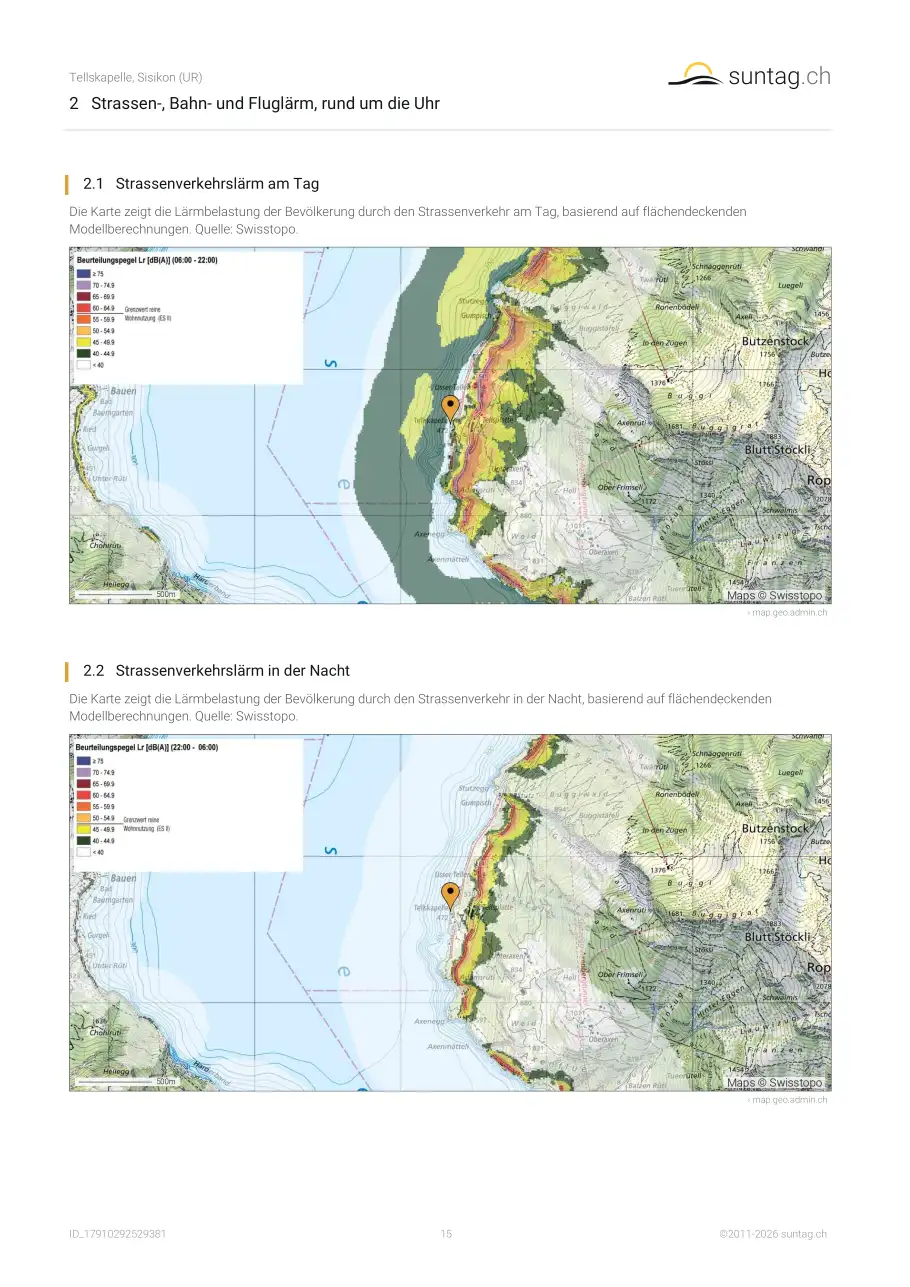
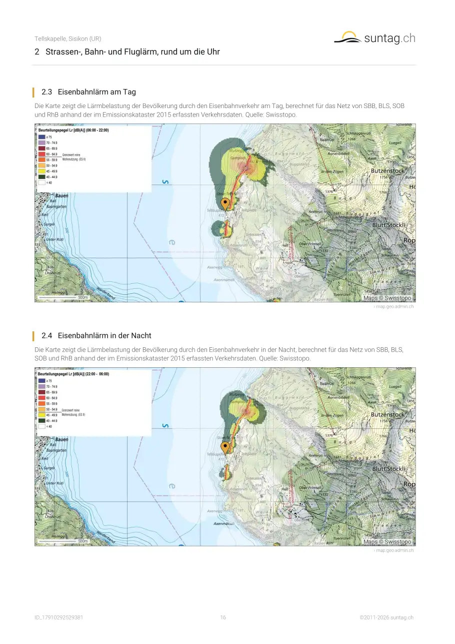
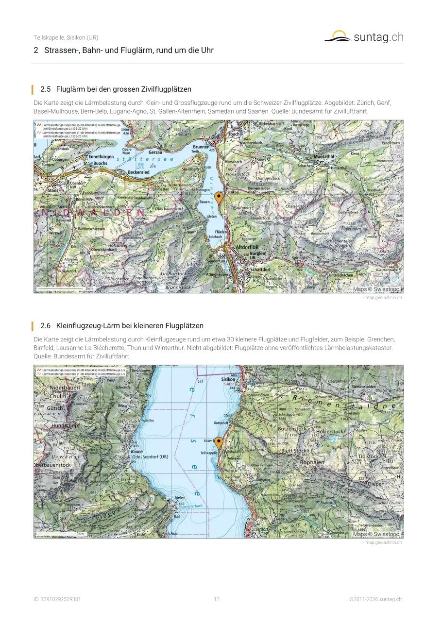
Schauen Sie sich die amtlichen Lärmkarten für Strassen-, Bahn- und Fluglärm an, für Tag und Nacht. Der suntag.ch-Bericht zeigt sie alle für Ihre Adresse, auch die Nachtkarte, die oft ein ganz anderes Bild liefert als eine ruhige Besichtigung. Unser Ratgeber
Lärmbelastung in der Schweiz erklärt, welche Grenzwerte in Wohnzonen gelten und wie man die Karten liest.
Wie beurteile ich, wie gut eine Adresse erschlossen ist?
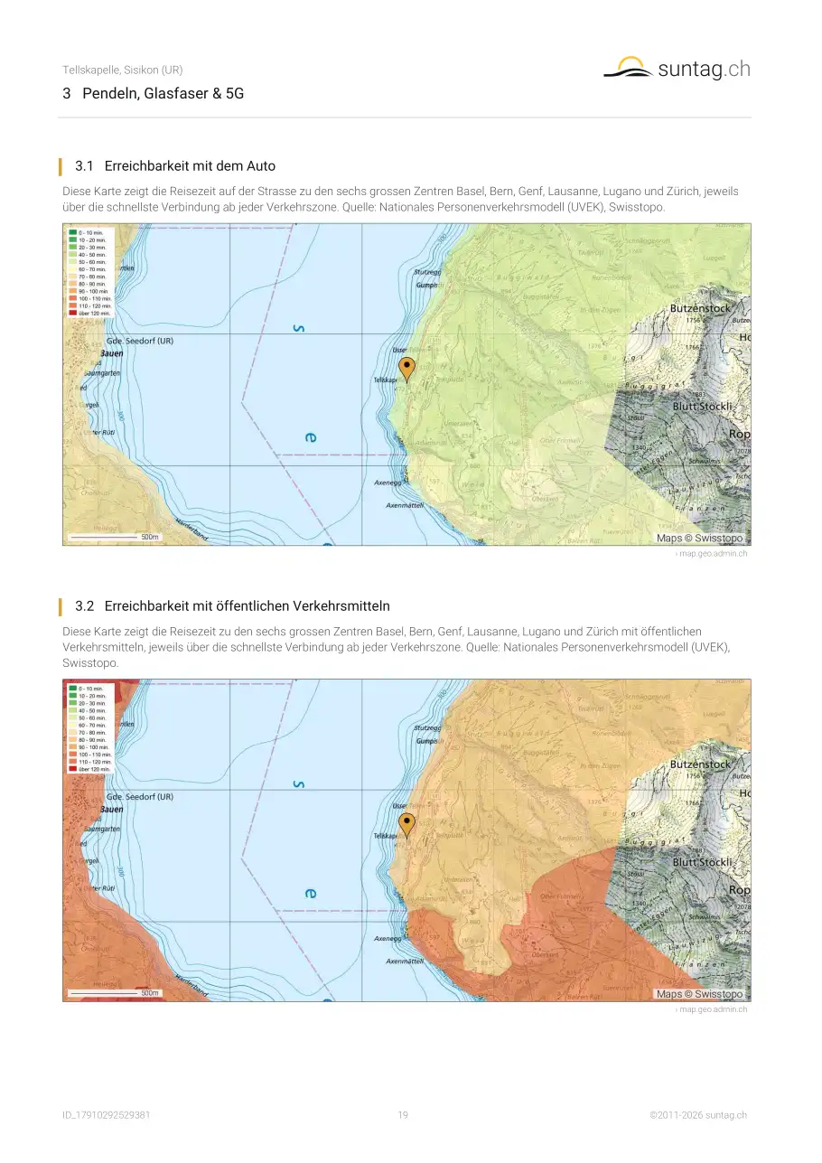
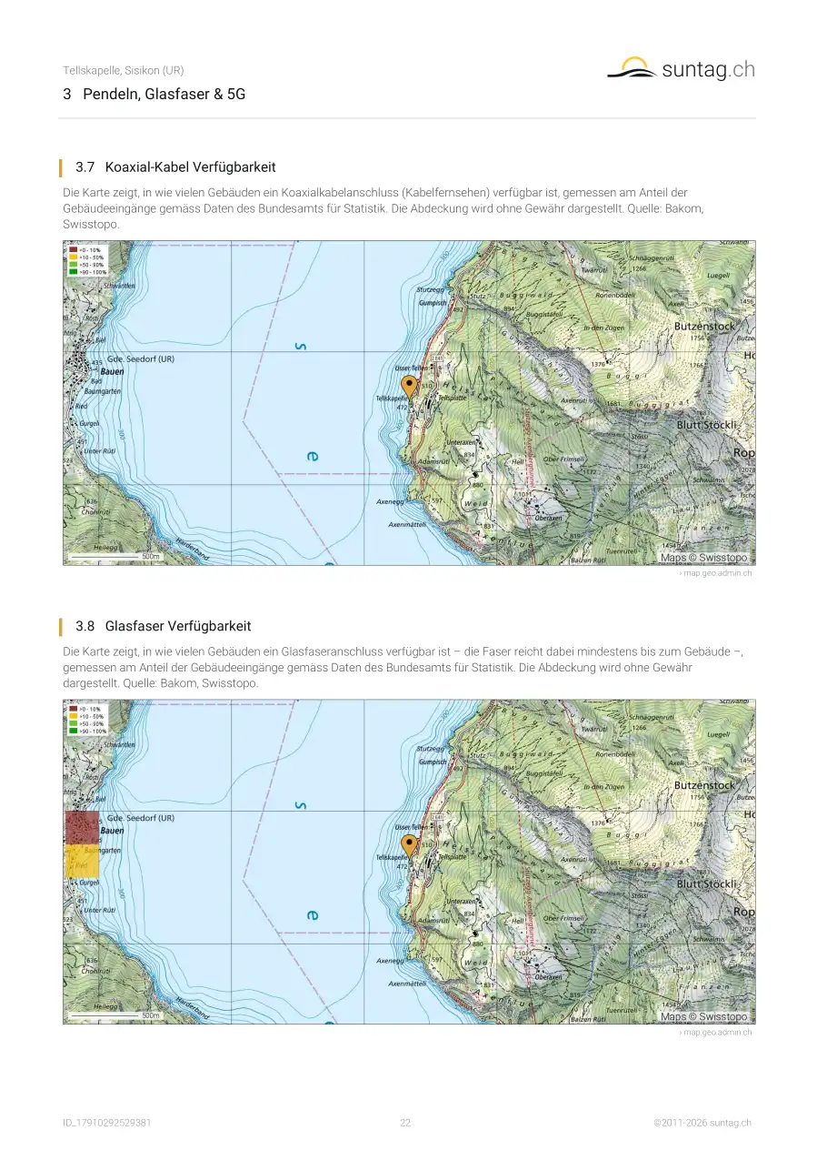
Drei Dinge zählen: die Reisezeit zu den nächsten Zentren mit Auto und öffentlichem Verkehr, die ÖV-Güteklasse (A bis D, vom Bundesamt für Raumentwicklung bewertet) und ob Glasfaser und 5G verfügbar sind. Der Bericht zeigt alle drei. Unser Ratgeber
Anbindung in der Schweiz erklärt die Klassen und wo man die einzelnen Werte prüft.
Gibt es Hochspannungsleitungen oder Kernkraftwerke in der Nähe meiner Adresse?
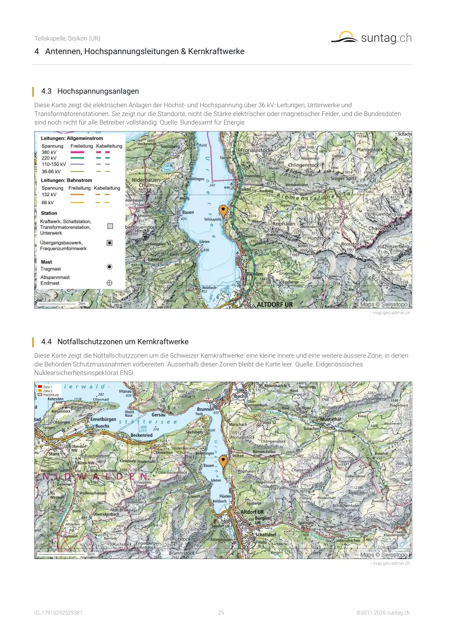
Der Bericht zeigt Hochspannungsleitungen und Unterwerke ab 36 kV und die Notfallschutzzonen um Kernkraftwerke, neben Mobilfunk- und Rundfunksendern, und nennt die Distanz zur nächsten Leitung. Die Karten zeigen Standorte, nicht die Feldstärke. Unser Ratgeber
Mobilfunkantennen, Hochspannungsleitungen und Notfallzonen erklärt die Schweizer Grenzwerte und wo man genaue Daten erfragt.
Darf neben einem Grundstück gebaut werden?
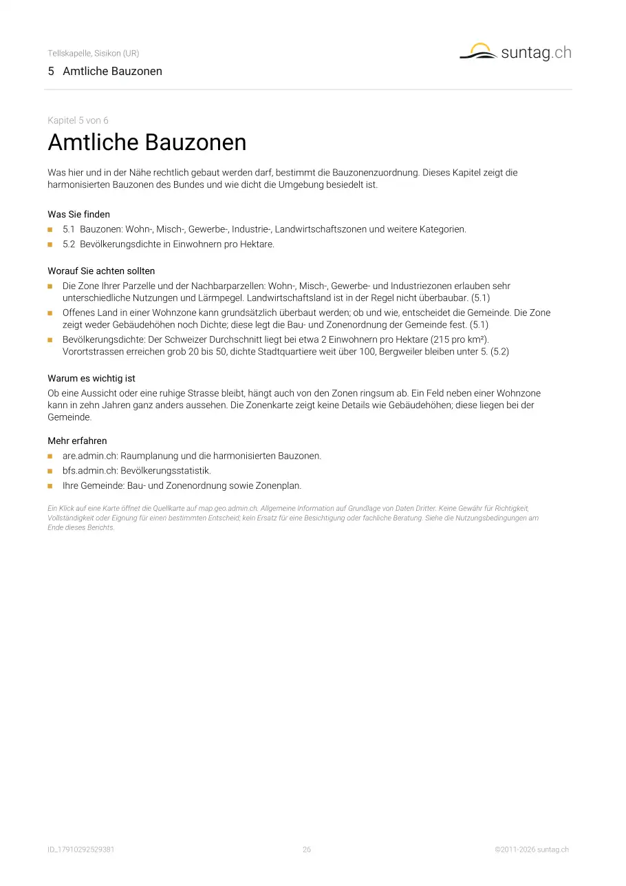
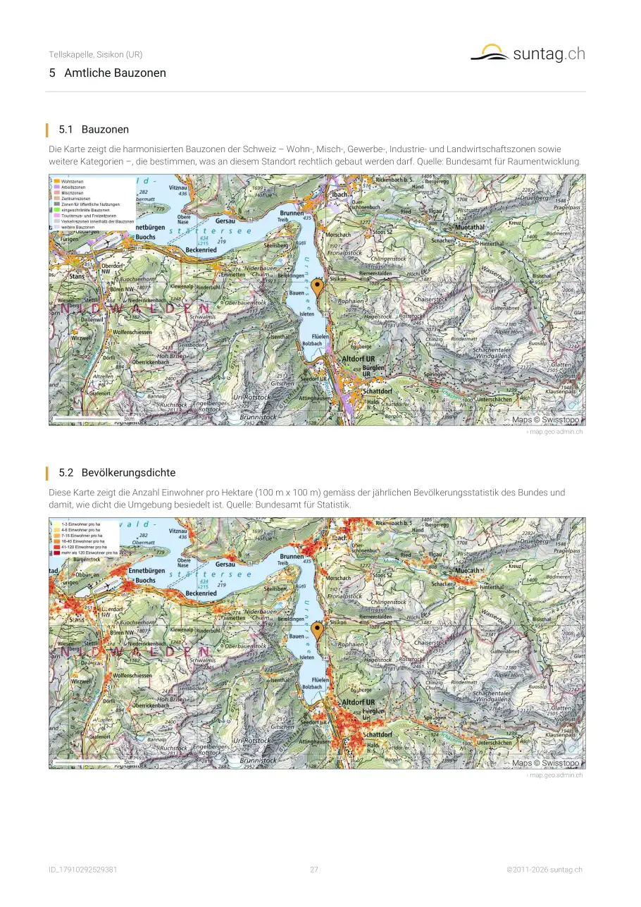
Die harmonisierte Bauzonenkarte des Bundes zeigt, was auf Ihrem Grundstück und auf den Nachbarparzellen erlaubt ist (Wohn-, Arbeits-, Landwirtschaftszonen und weitere). Sie ist eine Übersicht und nicht verbindlich: verbindlich ist der Zonenplan der Gemeinde. Unser Ratgeber
Bauzonen in der Schweiz erklärt die Kategorien und was die Karte nicht zeigt.
Welche Naturgefahren sollte ich vor dem Kauf einer Liegenschaft in der Schweiz prüfen?
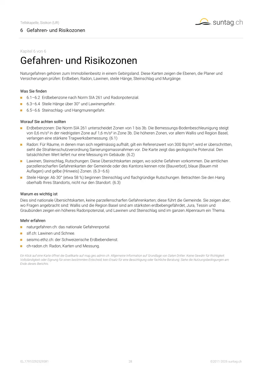
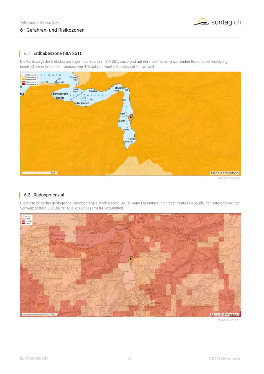
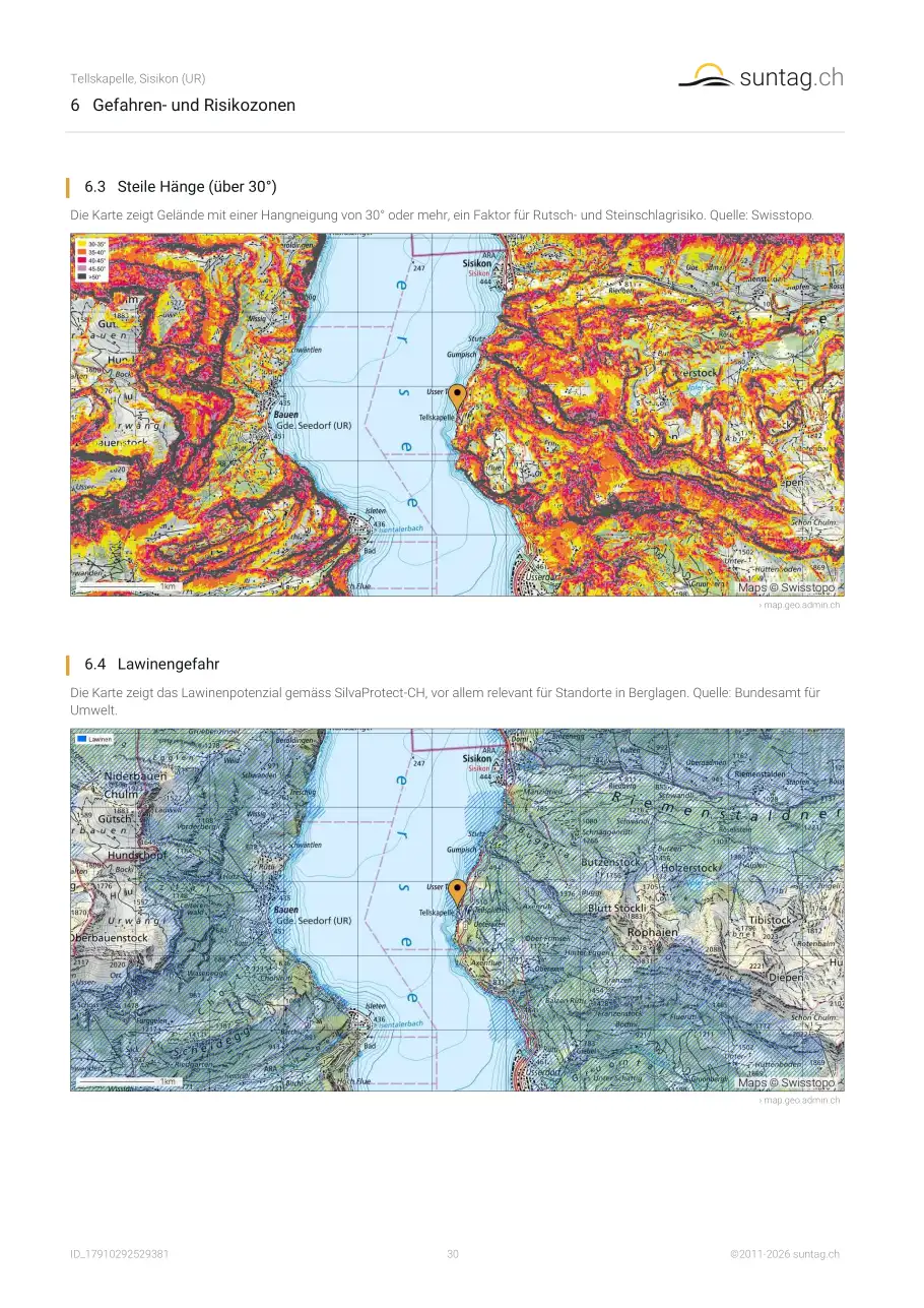
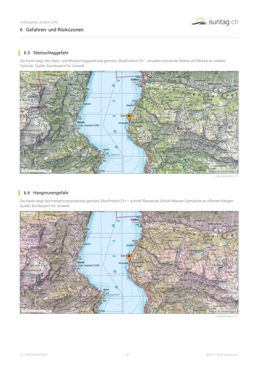
Erdbebenzone, Radon, Lawinen und Hangmuren. Der Bericht zeigt diese vier Übersichtskarten des Bundes für Ihre Adresse. Sie zeigen, wo man nachfragen sollte; die verbindlichen Unterlagen liegen bei der Gemeinde und beim Kanton. Unser Ratgeber
Naturgefahren in der Schweiz erklärt die Zonen und Werte.